Barn Island Wildlife Management Area - Sentinel Monitoring
Barn Island Color Slide Collection of Dr. William A. Niering, Connecticut College, New London, CT
Dr. Niering joined the staff of Connecticut College in the fall of 1952 and he made his first foray to Barn Island in the spring of 1953 with Dr. Frank Egler as trip leader. Dr. Niering would eventually lead his own field trips to Barn Island and used this as a field laboratory for many classes of students on the College. Dr. Niering slides from the 1953 to 1996 were scanned by Ron Rozsa, with the Coastal Management Program of the Department of Environmental Protection. The slides were scanned with a Fuji scanner and any annotations on the slides were saved in a spreadsheet. Annotation are Dr. Niering's notes on the slides. Comment offer clarification such as identifying the location.
May 22, 1953
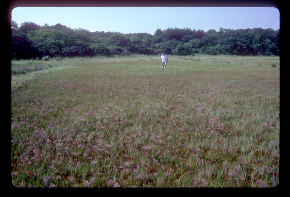
Slide #14: low resolution jpg, high resolution tiff
- Annotation: Barn. Is Marshes. E. Monert, J. Lake, C Avery
- Comment: Photo location is the turn around at the end of Palmer Neck Road constructed by the CT Board of Fisheries and Game. Today this is the location of the Barn Island Boat Launch Ramp.
Slide #15: low resolution jpg, high resolution tiff
- Annotation: Barn Is. Tidal Marshes - Conn.; House Porch So. East, Frank Egler
- Comment: The location is the porch of cottage on the Headquarters upland island. View is towards the boat launch ramp. The vegetation in the foreground may be the Panicum-Baccharis belt. The cottage was used as a headquarters building and eventually burned in the 1960's. The foundation of the cottage can still be found in what today is a wooded island.
Slide #17: low resolution jpg, high resolution tiff
- Annotation: Barn Is. Tidal Marshes - Conn; Impoundment #5
Slide #18: low resolution jpg, high resolution tiff
- Annotation: Barn Is. Tidal Marshes, Conn; Impoundment #5
Slide #19: low resolution jpg, high resolution tiff
- Annotation: Barn Is. Tidal Marshes, Conn.; North from parking area
Slide #20: low resolution jpg, high resolution tiff
- Annotation: Barn Island; Brown background Panicum virgatum narrow band Juncus dark green, front of rock - S. patens lighter green; Foreground Spartina glabra - low brown giving way to salt panne.
- Comment: Location is southern end of Headquarters upland, note the well established Panicum belt on the upland.This may be missing Scaylea photo 13. Two boulders in the upper tight corner of slide are photostation 12 (stand on right most rock and capture left corner of rock on left shooting angle into impoundment 1.
Slide #21: low resolution jpg, high resolution tiff
- Annotation: Barn Is. Tidal Marshes, Conn. Impoundment #1 Zonation-R-L Panicum, Juncus, Spartina patens, S. alterniflora, cattails in background.
- Comment: This is photostation 14 probably standing on the big rock instead of behind the big rock.
Slide #22: low resolution jpg, high resolution tiff
- Annotation: Barn Is. Tidal Marshes. Phragmites - record F. Egler.
September 24 1960:
Slide #3: low resolution jpg, high resolution tiff
- Annotation: Barn Is. Marshes; upland vegetation brown salt spray - Sept 1960 hurricane, oak-hickory brown
- Comment: Location is probably on the Headquarters upland looking eastward. To the right of the salt spray impacted shrubs is a Panicum belt - probably the one near the Headquarters cottage. Hurricane Donna
Slide #4: low resolution jpg, high resolution tiff
- Annotation: Barn Is - storm 9/12/60 - salt spray damage - Bayberry-green, blueberry cherry darker
September 26, 1963:
Except for slides 27-29; most of these slides are taken at Brucker Marsh where Dr. Niering's student Alfred Gross is studying the marsh before it is impounded by Connecticut.
Slide #21: low resolution jpg, high resolution tiff
- annotation: Barn Island; Gray dogwood thicket 10 ft white and 10 ft cherry
Slide #22: low resolution jpg, high resolution tiff
- annotation: Barn Is., Juncus belt left, bare right
- comment: this appears to be the 'eroded edge', the cyclic erosion of Juncus peat at the upland edge; note the Panicum belt to the right; the lower slope of tis belt is where the next Juncus belt will form; this photo is on the Headquarters Marsh along the upland border looking across dike 1 in the background.
Slide #23: low resolution jpg, high resolution tiff
- annotation:Barn Is. Brucker Marsh; Soidago sempervirens view toward LI Sound; Cattails red maple dead, Iva on levee.
Slide #24: low resolution jpg, high resolution tiff
- annotation: Davis Marsh; left of wall "Juvenxt and Sol. sempervirens" grazed; Panicum to right
Slide #25: low resolution jpg, high resolution tiff
- annotation: Barn Is Marshes; Triglochin sampled area
- comment: This is the forb panne community that forms after the dieback of Juncus, the location is the Headquarters Marsh with dike 2 in the background.
Slide #26: low resolution jpg, high resolution tiff
- annotation: Barn Is.; Triglochin with Juncus around rock
Slide #27: low resolution jpg, high resolution tiff
- annotation: Barn Is; Juncus foreground "…" from sandy beach
- comment: likely a photograph of the Headquarters Marsh taken from the sandy beach at the bayfront; dike 2 is in the background
Slide #28: low resolution jpg, high resolution tiff
- annotation: Barn Island; Solidago sempervirens
Slide #29: low resolution jpg, high resolution tiff
- annotation: Barn Is.; Juncus foreground ".." from sandy beach
August 9, 1965:
Slide #14: low resolution jpg, high resolution tiff
- Annotation: Barn Is tidal marsh; Hibiscus moscheutos
September 17, 1965:
Slide #2: low resolution jpg, high resolution tiff
- Annotation: Barn Island Natural Area; View east from channel; marsh and upland
- Comment: a 3-year trial natural area preserve was established by the Connecticut Board of Fisheries and Game beginning 1965. This included the marsh and islands south of the boat channel.
June 1969:
Slide #1: low resolution jpg, high resolution tiff
- Annotation: Barn Island; below Brucker
June 15, 1971:
Slide #16: low resolution jpg, high resolution tiff
- Annotation: spoil on marsh
Slide #17: low resolution jpg, high resolution tiff
- Annotation: fill on marsh
Slide #18: low resolution jpg, high resolution tiff
- Annotation: spoil on marsh since removed from impoundment construction
- Comment: Impoundment 3 (installation of culvert at far west end - Hebard 1980); note the prominent Panicum belt along west edge of impoundment.
August 16, 1973:
Slide #6: low resolution jpg, high resolution tiff
- Annotation: Forb panne, Egret, Limonium flowering, Gerardia scattered, st S. alter.
Slide #18: low resolution jpg, high resolution tiff
August 1974:
Slide #19: low resolution jpg, high resolution tiff
- Annotation: west of parking lot; Panicum virgatum left; Juncus gerardii, Spartina patens; unditched marsh
- Comment: marsh unit called Wequetequock Point. This point is one large bayfront levee.
Slide #21: low resolution jpg, high resolution tiff
- Annotation: Permanent photo; east of impoundment 1
- Comment: This is the Headquarters Marsh photostation 13.
October 18, 1974:
Slide #1: low resolution jpg, high resolution tiff
- Annotation: "retake" summer 1974
- Comment: Headquarters marsh, note the prominent Panicum belt and the two large boulders on the right side of photo - the right most boulder is where you stand to take photos at photostation 12.
Slide #2: low resolution jpg, high resolution tiff
- Annotation: F.E. Egler
- Comment: Headquarters Marsh - Egler's index fingertip is 'touching' the boulder that is photostation 12.
Slide #3: low resolution jpg, high resolution tiff
- Annotation: former Juncus upper border now Triglochin and forbs; Distichlis spicata; F.E. Egler
- Comment: Headquarters Marsh.
Slide #4: low resolution jpg, high resolution tiff
- Annotation: impoundment no. 2; islands of S. patens;stunted SA
Slide #5: low resolution jpg, high resolution tiff
- Annotation: impoundment
- Comment: impoundment 5
October 1975:
Slide #2: low resolution jpg, high resolution tiff
- Annotation: below Imp #1; Scott Warren and salt marsh summer crew
- Comment: Headquarters marsh?
August 1976:
Slide #2: low resolution jpg, high resolution tiff
- Annotation: Brucker; seeded; drained
Slide #9: low resolution jpg, high resolution tiff
- Annotation: Hebard Independent study above imp. 1
Slide #35: low resolution jpg, high resolution tiff
- Annotation: Below impoundment 2
- Comment: Below west end of dike 3.
August 18, 1979:
Slide #19: low resolution jpg, high resolution tiff
- Annotation: Below Brucker; short SA some SP; 7 m wide swath; 3-5 cm deep
- Comment: thin layer sediment broadcast by Mosquito Control's new amphibious rotary ditching machine.
Slide #20: low resolution jpg, high resolution tiff
- Annotation: new Mosquito control technology; 7 m wide;3-5 cm deep
Slide #21: low resolution jpg, high resolution tiff
- Annotation: new mosq. ditching technology; 3-5 cm
Slide #22: low resolution jpg, high resolution tiff
- Annotation: mosquito ditching along ditch head duck hole; covering SP + SAS
Slide #26: low resolution jpg, high resolution tiff
- Annotation: below impoundment 1, ditch 2 from parking lot with thick organic layer 3"-6"; forb area
Slide #27: low resolution jpg, high resolution tiff
- Annotation: below imp#1; ditch 2 from parking lot; post ditch spewing
June 1, 1983:
Slide #7: low resolution jpg, high resolution tiff
- Annotation: Pure Distichlis below east end Brucker; very wet
Slide #15: low resolution jpg, high resolution tiff
- Annotation: Imp. 1 Typha/cattail
Slide #23: low resolution jpg, high resolution tiff
- Annotation: Between Imp#1 and 2; front marsh; Juncus belt
- Comment: Headquarters Marsh, path/eroded edge present
Slide #24: low resolution jpg, high resolution tiff
Slide #26: low resolution jpg, high resolution tiff
- Annotation: Juncus/Triglochin belt; between 1 and 2 along edge of marsh
- Comment: Headquarters marsh, Juncus belt not seen by Coleman (1978) in 1976 has returned by 1983 but is entering the erosion phase.
Slide #28: low resolution jpg, high resolution tiff
- Annotation: Imp #3 - open water high tide one in the sequence of 3; Spartina/JG/PV SAS + Triglochin
- Comment: impounded condition, spring tides can overtop weir boards creating a brackish condition
Slide #30: low resolution jpg, high resolution tiff
- Annotation: sequence 3; Imp #3; open water Spartina alt islands
Slide #31: low resolution jpg, high resolution tiff
- Annotation: In between 2 + 3; Dist spic. Poison Ivy
- Comment: Impoundment 3a
Slide #32: low resolution jpg, high resolution tiff
- Annotation: unditched marsh south of parking lot; Distichlis roots penetration 6" tall grass flotsam
- Comment: Wequetequock Point
Slide #33: low resolution jpg, high resolution tiff
Slide #34: low resolution jpg, high resolution tiff
- Below Imp#1; view east Iva foreground; Spartina dominant; Permanent Photo station
Slide #35: low resolution jpg, high resolution tiff
- Permanent photo station; Increase Iva since 1976; see Coleman's thesis
Slide #36: low resolution jpg, high resolution tiff
- Annotation: Ditching spoil; spewed on marsh; increased green color out from ditch
Slide #37:low resolution jpg, high resolution tiff
- Annotation: from Impoundment
June 6, 1983:
Slide #37: low resolution jpg, high resolution tiff
August 10, 1983:
Slide#4: low resolution jpg, high resolution tiff
- Annotation: Davis Marsh; Juncus & Iva near creek; Spartina patens
Slide #5: low resolution jpg, high resolution tiff
- Annotation: Davis - Sas panne toward upland from S. patens
Slide #6: low resolution jpg, high resolution tiff
- Annotation: Below Brucker to east; Pure Distichlis heads near upland very wet.
- Comment: East side of Brucker Creek below dike 5. Panicum fen in the background and lower right corner of slide. To the left of this corner is sparse dark Triglochin colonizing the eroded edge (former Juncus belt). Distichlis has likely colonized the seaward edge of the eroded edge.
Slide #14: low resolution jpg, high resolution tiff
- Annotation:
- Comment: Nyssa forested wetland to the east of dike 3.
Slide #29: low resolution jpg, high resolution tiff
- Annotation: Egler panne sequence Bare/forbs/SAS
Slide #31: low resolution jpg, high resolution tiff
Slide #32: low resolution jpg, high resolution tiff
- Annotation: Panne sequence 2 of 3; Below 2A Impoundment; SAS/forbs/JG beyond
Slide #36: low resolution jpg, high resolution tiff
- Annotation: Lower Brucker west; Sas/sp dominant; duck pond banks
May 1987:
Slide #2: low resolution jpg, high resolution tiff
- Annotation: Barn Is; OMWM; unditched marsh near parking lot; dug 3/87
- Comment: Wequetequock Point
Slide #6: low resolution jpg, high resolution tiff
- Annotation: Imp #3
- Comment: Two weir boards were removed from impoundment 3 in order to have the position of low tide match the elevation of the pond bottom to form a tidal flat. The flat remained bare for several years and then it was converted to low marsh dominated by Spartina alterniflora. The likely cause of that change was the slide gate on the side of the concrete box chamber fell off which lowered the position of low tide.
Slide #8: low resolution jpg, high resolution tiff
- Annotation: Imp #2
- Comment: This marsh was impounded until 1978 when the tidal flow was restored.
Slide #34: low resolution jpg, high resolution tiff
- Annotation: SAS marsh to osprey platform
Slide #37: low resolution jpg, high resolution tiff
- Annotation: snowy egret; dug out area
June 1987:
Slide #1: low resolution jpg, high resolution tiff
- Annotation: near Davis Marsh
Slide #2: low resolution jpg, high resolution tiff
- Annotation: none
- Comment: similar to #1 above
Slide #3: low resolution jpg, high resolution tiff
- Annotation: none:
- Comment: Likely a photograph of the eroded edge near the Brucker Marsh with the sandy ridges supporting Panicum fens.
Slide #4: low resolution jpg, high resolution tiff
- Annotation: none:
- Comment: Resembles the sandy ridge south of dike 5 and west of Brucker Creek
Slide #5: low resolution jpg, high resolution tiff
- Annotation: none
- Comment: Photograph of the eroded edge at the Triglochin stage of colonization
Slide #9: low resolution jpg, high resolution tiff
Slide #10: low resolution jpg, high resolution tiff
- Annotation: Davis Marsh
- Comment: Eastern boundary of Barn Island looking northeast towards the Davis Marsh
Slide #12: low resolution jpg, high resolution tiff
- Annotation: Below Brucker; SAS reddish
Slide #18: low resolution jpg, high resolution tiff
- Annotation: none
- Comment: view from dike 3 looking south
Slide #19: low resolution jpg, high resolution tiff
Slide #20: low resolution jpg, high resolution tiff
- Annotation: none
- Comment: Looking southwest from dike 3
Slide #22: low resolution jpg, high resolution tiff
Slide #23: low resolution jpg, high resolution tiff
- Annotation: none
- Comment: Photostation #12.
Slide #24: low resolution jpg, high resolution tiff
- Annotation: Barn Is' Imp 1; Spartina marsh restoration
Slide #25: low resolution jpg, high resolution tiff
Slide #26: low resolution jpg, high resolution tiff
Slide #27: low resolution jpg, high resolution tiff
Slide #29: low resolution jpg, high resolution tiff
- Annotation: control unditched
- Comment: Wequetequock Point marsh; this entire marsh is bayfront levee and so serves as a reference for other ditched bayfront levees only.
Slide #30: low resolution jpg, high resolution tiff
- Annotation: control adj parking lot; Weq Point Marsh
Slide #34: low resolution jpg, high resolution tiff
- Annotation: Palmer Neck marsh
October 16, 1987:
Slide #1: low resolution jpg, high resolution tiff
- Annotation: Palmer Neck;pan sequence 3 of 3; Iva surround; HQ beach
Slide #2: low resolution jpg, high resolution tiff
- Annotation: Palmer Neck below Imp#1; Pan sequence 2 of 2; Iva-Forbs-SAS
Slide #3: low resolution jpg, high resolution tiff
- Annotation: Palmer Neck Below Imp.#1; Panne sequence 1of 3
Slide #5: low resolution jpg, high resolution tiff
- Annotation: mosquito ditch; fiddler crab in burrow
Slide #8: low resolution jpg, high resolution tiff
- Annotation: view eastward below Imp#2; SAS-Iva foreground
Slide #9: low resolution jpg, high resolution tiff
- Annotation: Marsh Sas below Imp#2; Black Gum in color
Slide #10: low resolution jpg, high resolution tiff
- Annotation: Below Imp#2; SAS-S.patens foreground
Slide #12: low resolution jpg, high resolution tiff
- Annotation: Scott in former Juncus belt now Triglochin; Headquarters
- Comment: In 1983, there was a 'path' (eroded edge) around the Headquarters marsh; by 1987 it was apparent that this was not a path for the path which formed in the Juncus belt, led to the loss of all the Juncus, the Juncus became exposed peat and then would be colonized by Triglochin.
Fall 1987:
Slide #6: low resolution jpg, high resolution tiff
- Annotation: Palmer Neck, Headquarters Marsh; Iva between ditch
- Comment: Palmer Neck if foreground, Headquarters in the background
Slide #7: low resolution jpg, high resolution tiff
- Annotation: Palmer Neck to Imp #1; SAS Forbs; Iva consp shrub
Slide #8: low resolution jpg, high resolution tiff
- Annotation: Weq Cove, unditched control; Sp foreground; Juncus bckground
- Comment: View from Headquarters Marsh toward Wequetequock Point
Slide #14: low resolution jpg, high resolution tiff
- Annotation: Palmer Neck; forb panne
Slide #15: low resolution jpg, high resolution tiff
- Annotation: Palmer Neck; unditches, SAS
Slide #21: low resolution jpg, high resolution tiff
- Annotation: DS dead rhizomes
- Comment: These are Panicum virgatum rhizomes in the eroded edge on Headquarters Marsh.
Slide #22: low resolution jpg, high resolution tiff
- Annotation: Distichlis spicata rhizomes dead with Triglochin
- Comment: Rhizomes of Panicum virgatum in the eroded edge on Headquarters marsh.
Slide #28: low resolution jpg, high resolution tiff
- Annotation: Scott SA veg sampling
- Comment: Headquarters Marsh
June 1990:
Slide #16: low resolution jpg, high resolution tif
- Annotation: students Matt/Anne; productivity; Imp #1
July 3, 1990:
Slide #27: low resolution jpg, high resolution tif
- Annotation: Weq Point Marsh; Sp.Jg/Panicum Iva; belting
Slide #31: low resolution jpg, high resolution tif
- Annotation: Headquarters transect; Jg foreground - SAS background
Slide #32: low resolution jpg, high resolution tif
- Annotation: Headquarters; sampling
Slide #33: low resolution jpg, high resolution tif
- Annotation: Palmer Neck; sparrows nest
Slide #34: low resolution jpg, high resolution tif
- Annotation: Palmer Neck; transect; J.g./forbs/SAS/Sp
Slide #35: low resolution jpg, high resolution tif
- Annotation: Palmer Neck Marsh; transect Jg/Forbs/SAS/Sp
Slide #36: low resolution jpg, high resolution tif
- Annotation: Anne testing redox
August 1990:
Slide #3: low resolution jpg, high resolution tif
- Annotation: Headquarters below Imp# 1; view east over headquarters
Slide #4: low resolution jpg, high resolution tif
- Annotation: Below Imp. #1; from Imp 1 to Palmer Neck
Slide #6: low resolution jpg, high resolution tif
- Annotation: Headquarters SAS dom.
Slide #7: low resolution jpg, high resolution tif
- Annotation: none
- Comment: Headquarters Marsh based on slide sequence
Slide #8: low resolution jpg, high resolution tif
- Annotation: Barn Is; Headquarters marsh; sharp transformation DS + SAS
Slide #9: low resolution jpg, high resolution tif
Slide #10: low resolution jpg, high resolution tif
- Annotation: Headquarters Marsh to Imp #1; Phragmites on dike
Slide #11: low resolution jpg, high resolution tif
- Annotation: Headquarters Marsh
Slide #16: low resolution jpg, high resolution tif
June 1991:
Slide #14: low resolution jpg, high resolution tif
- Annotation: orientation; Warren/Fell + students
Slide #21: low resolution jpg, high resolution tif
- Annotation: Davis marsh; view upper valley dead of ?
Slide #22: low resolution jpg, high resolution tif
- Annotation: Davis Marsh; death of trees in lifetime of John Davis; upper marsh
- Comment: This appears to be marsh transgression of Panicum belt and Cedars dying from flooding; there appears to be a healthy Juncus belt forming adjacent to the Panicum belt.
Slide #25: low resolution jpg, high resolution tif
- Annotation: flotsom east of Headquarters
Slide #27: low resolution jpg, high resolution tif
Slide #30: low resolution jpg, high resolution tif
- Annotation: toward Davis Marsh
Slide #31: low resolution jpg, high resolution tif
- Annotation: from narrow cattail to Spartina marsh; restoration; impoundment open to salt
October 1996:
Slide #X: low resolution jpg, high resolution tif
Slide #XX: low resolution jpg, high resolution tif
|


